Skip to content
Simvix
ProductPart of Simvix

radartrenes.com

Every train in real time, free, and a warning within seconds when something goes wrong

Free real-time train map in the style of flight radars, with positions and delays from real sources, track infrastructure and the position shared by phones on board, plus a safety engine that warns within seconds when a train stops where it should not. No account, no fee.

Mapa claro de la península con los trenes en vivo coloreados por puntualidad y la lista lateral con sus retrasos

Why it exists

On 18 January 2026, in Adamuz, a train derailed after a rail broke and about 15 seconds later it was hit by another train running on the adjacent track. There was no channel to warn the second train that a stopped train was ahead. radartrenes.com exists to close that window of seconds: if every train is visible in real time and an abnormal stop is broadcast instantly, the train behind can know in time.

What it is for

It has two goals. First, to give anyone, with no account and free of charge, a live map of the trains in service with their position, speed, heading, delay, source and data age, like the ones that already exist for aircraft. Second, to watch the network on that map with a safety engine that detects sudden stops, trains stopped on the line, dangerous convergences, overspeed and signal loss, and warns the trains involved first and then the whole network. radartrenes.com complements official railway signalling; it does not replace it and is not a certified safety system, and it says so on screen.

Already in production

radartrenes.com shows hundreds of real trains at once: Renfe Cercanías commuter trains from their open real-time data and the Finnish network from Fintraffic / Digitraffic. It crosses the timetable with the position to give each train’s delay, its next stop and a punctuality colour, and overlays OpenRailwayMap tracks, signals, maximum speeds and electrification. The safety engine watches those trains live and shows its alerts on the map and in their own panel. Passengers, crew and drivers can turn their phone into one more source with the “share my position” mode, and any other system can connect through the open TROP v1 protocol, documented in OpenAPI 3.1.

Free for everyone

Using radartrenes.com is free: no sign-up and no account, in the browser or installed on your phone as a web app. For operators, infrastructure managers and companies that want to build it into a commercial product or service there is a commercial licence: write to us from this page.
Modules and features

Enable only what you need and expand as you grow.

01

Live map

  • Real trains with position, speed, heading, source and data age
  • OpenRailwayMap layers: tracks, signals, maximum speed and electrification
  • Free and with no account, in the browser or installed on your phone
02

Timetables and delays

  • Each train’s delay from timetable and position, with a punctuality colour
  • Route, next stop and scheduled and estimated time
03

Safety engine

  • Detection of sudden stops, trains stopped on the line, dangerous convergence, overspeed and signal loss
  • Warning within seconds to the whole network and full screen on the trains involved
04

Data sources

Screenshots

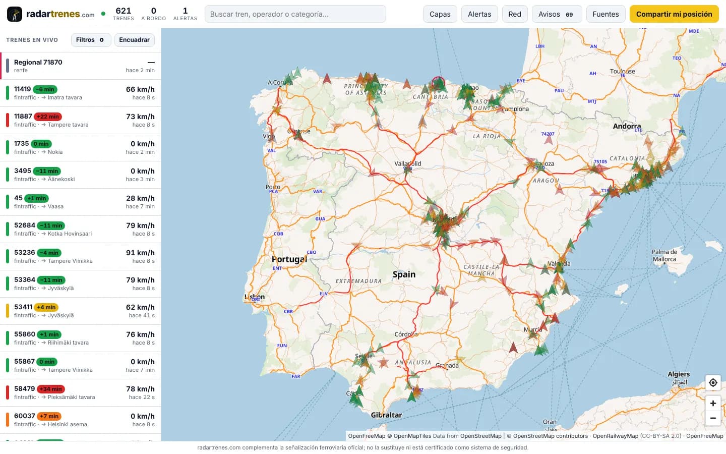
Light map of the Iberian Peninsula with live trains coloured by punctuality and the side list with their delays
Live map: hundreds of real trains on a light map with cities, roads and tracks
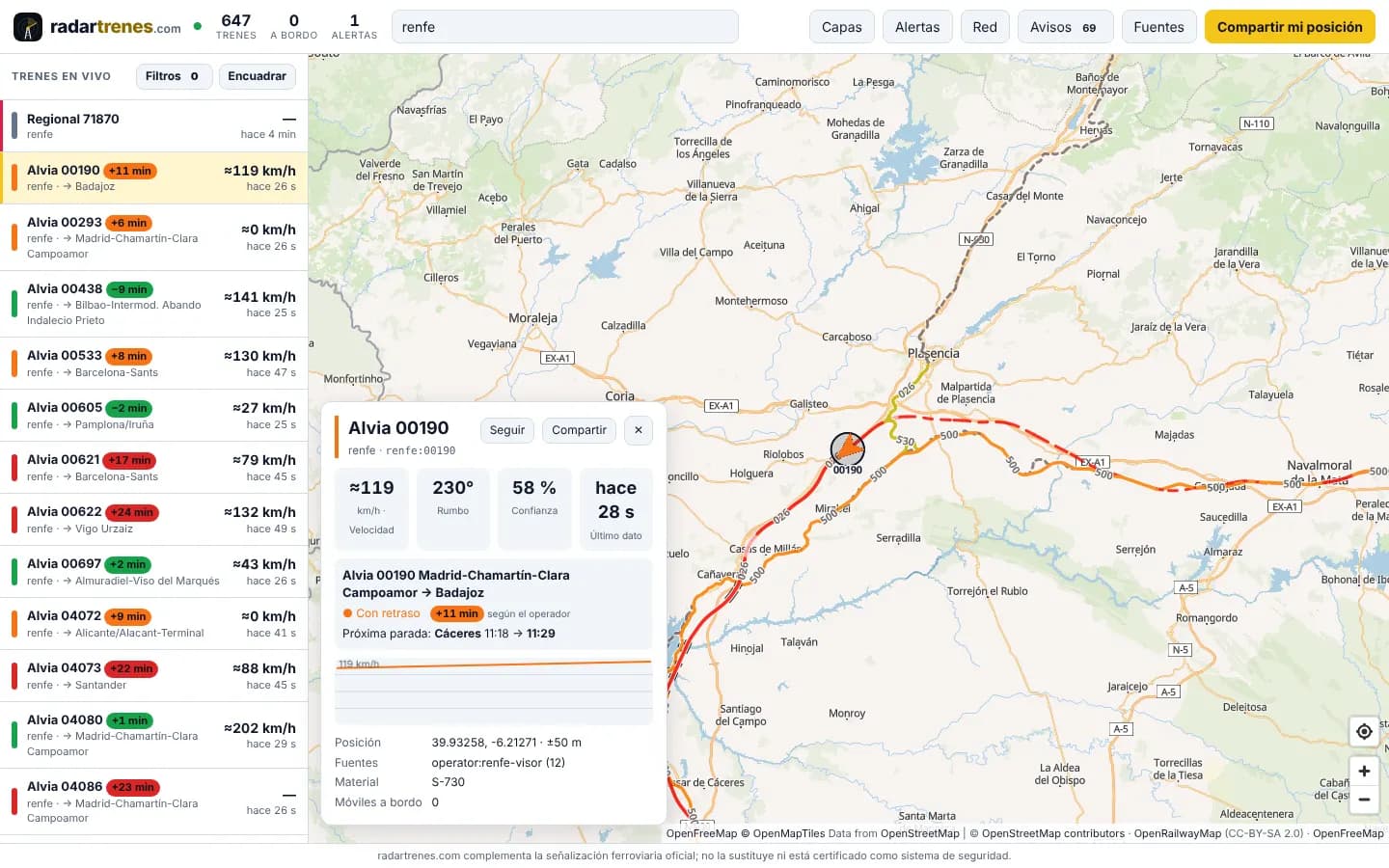
Card of an Alvia train Madrid–Badajoz running 11 minutes late, next stop Cáceres
Train card: route, delay, next stop, speed, rolling stock and data source
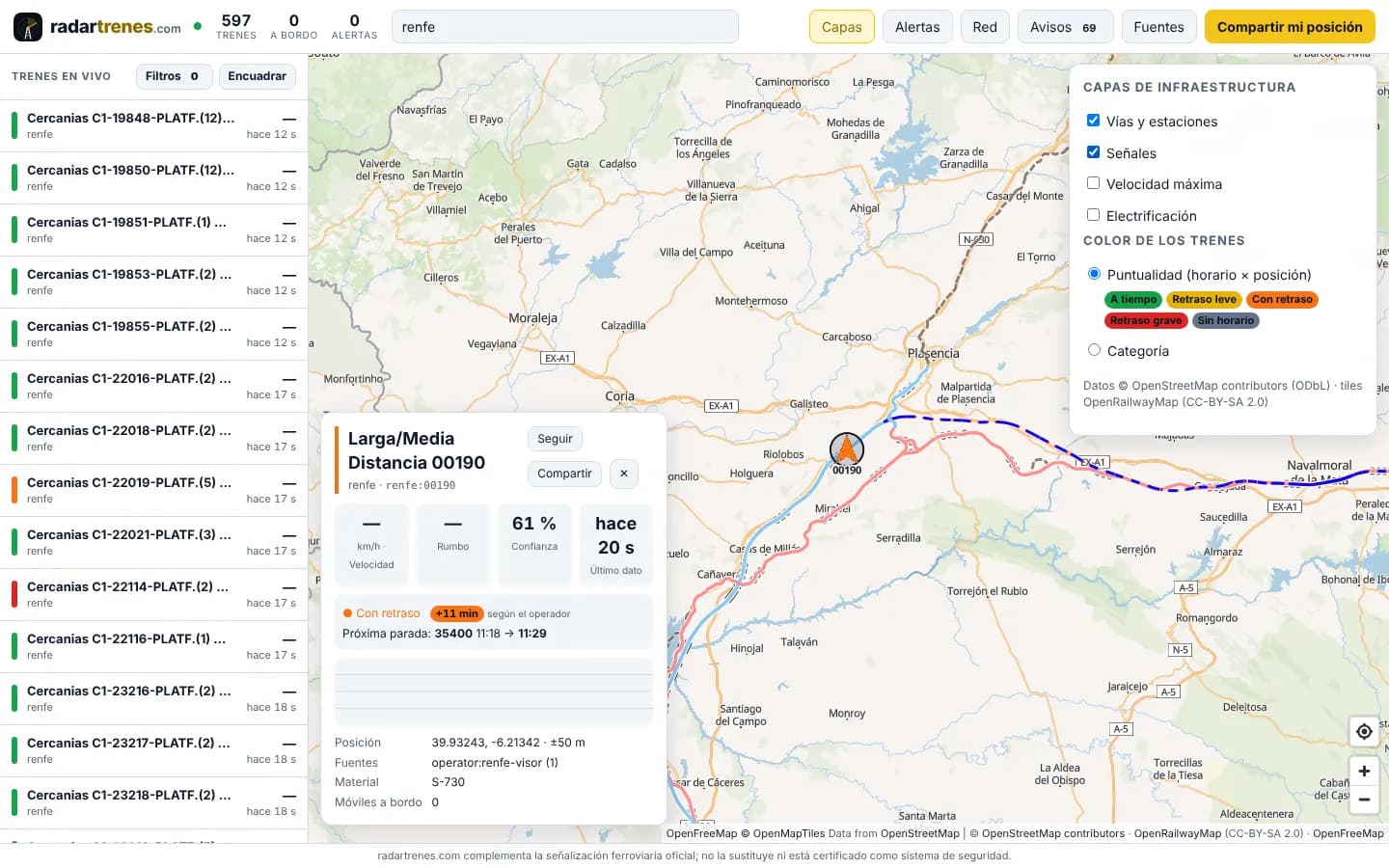
Map with the track and signal layers on and the punctuality legend open
OpenRailwayMap track and signal layers, with trains coloured by punctuality
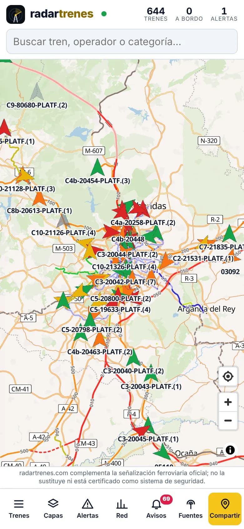
Phone screen with Madrid commuter trains and the bottom action bar
On the phone: Madrid’s commuter trains and every action within thumb’s reach

Frequently asked questions

Why was radartrenes.com built?

Because of the Adamuz accident (18 January 2026): a train derailed after a rail broke and about 15 seconds later it was hit by another train running on the adjacent track. There was no channel to warn the second train that a stopped train was ahead. radartrenes.com targets that window of seconds: see every train in real time and raise the alarm as soon as one stops where it should not.

What is it for?

Two things: give anyone a free map of the trains in service, like the ones that exist for aircraft, and watch the network on top of it with a safety engine that spreads a sudden stop, a train stopped on the line or a dangerous convergence within seconds, with priority for the trains involved. It complements official railway signalling; it does not replace it and is not a certified safety system.

Is it free?

Yes. Using radartrenes.com is free, with no account and no sign-up, both to watch the map and to share your position from the train. If you are an operator, an infrastructure manager or a company and want to build it into a commercial product or service, write to us from this page and we will explain the terms of the commercial licence.

Where does the data come from?

Today, from the open real-time data of Renfe Cercanías commuter trains (GTFS-Realtime: positions and delays) and of Fintraffic / Digitraffic in Finland, from OpenRailwayMap infrastructure and from the phones of people sharing their position on board. Every train shows its source and data age, and other systems can connect through the open TROP v1 protocol.

Related articles

Want to see radartrenes.com in action?

Request a demo or tell us about your case: we answer within one business day.

radartrenes.com: free real-time train map | Simvix